The Unique Geology of the Lost River Valley
3 Days/2 Nights
Gateway: Hailey, Idaho
Billions of years ago, Idaho lay at the edge of the Pacific Ocean, tethered to a land mass resting on the North American geologic plate. When the plate began clashing with the Pacific Plate that lay at the bottom of the ocean, the North American plate was driven deep into the earth’s crust. Molten magma began shooting up through the fissures as the plate was buried, cooling into the craggy, crystallized granite rocks forming the jagged skyline profiles punctuating the region. More magma thrusting up through a crack in the plate became tortured volcanic rocks of the many mountain ranges that frame the landscape of south-central Idaho that was once the Pacific Ocean shoreline.
It was an exciting time in the geologic world, as the continents as we know them were forming. About 900 million years ago, before the geologic plates began sliding on the earth’s surface, Australia, now floating in the Pacific Ocean in the southern hemisphere, was separated from Idaho by only a very narrow seaway. As Australia slipped away, the Pacific Rim Ring of Fire volcanoes began to form, pushing slices of volcanic rocks onto the Continental Shelf at the edge of now Idaho.

About 600 million years later, when more volcanoes exploded, deep-water rocks were thrown on top of the slices, and the eroded, folded, and faulted landscapes pushed eastward to form Washington and Oregon offshore. Thick piles of sediment formed the Salmon River arch, the calderas at Challis, and the Yellowstone River, ultimately creating Craters of the Moon National Monument, which appears as it did millions of years ago.
Every 3,000 years or so, the Shoshone Tribe, which had been residing in the area for some 12,000 years, witnessed the dynamic geologic events that created the landscapes you will see as you explore. Not only did the geologic turmoil create the landscape, but it also deposited precious and useful minerals that have kept the economy in the region going for centuries, which are still being mined today.

Together, the geologic phenomenon and the mining they rendered created a story that intertwines the mining heritage, ghost towns, and the culture of the rugged West with the majestic, timeless landscape surrounding them. Today, you can explore mining towns like Mackay, Arco, Bonanza, and Bay Horse, quaint places where residents live a timeless Western lifestyle that has not changed much in a couple of centuries amidst the grandeur of the Lost River Range.
Recent earthquakes foretell that the geologic disruptions may not be totally over, and Mother Nature may not be finished with her handiwork on the landscape. Another show of natural force is not likely to occur in our lifetime, so plan to savor the beautiful mountains created so long ago and left for all to enjoy. Discover the geologic and natural wonders of the Lost River Valley!
DAY ONE

Silver Creek Preserve
The Nature Conservancy’s 1979 purchase of 479 acres of the Sun Valley Ranch enabled the development of a flagship preserve at Silver Creek that also launched a landowner conservation effort along the stream to protect an additional 12,000 acres. The Preserve now covers over 880 acres of land along Silver Creek, home to various wildlife, including bald eagles, river otters, mule deer, and more than 150 species of birds. It is also one of the premier trout streams in the country, known for its abundance of rainbow, brown, and cutthroat trout for world-class fly fishing.
165 Kilpatrick Bridge Road, Bellevue, ID 83313 208-788-7910 6AM-9PM Daily
Craters of the Moon National Monument and Preserve
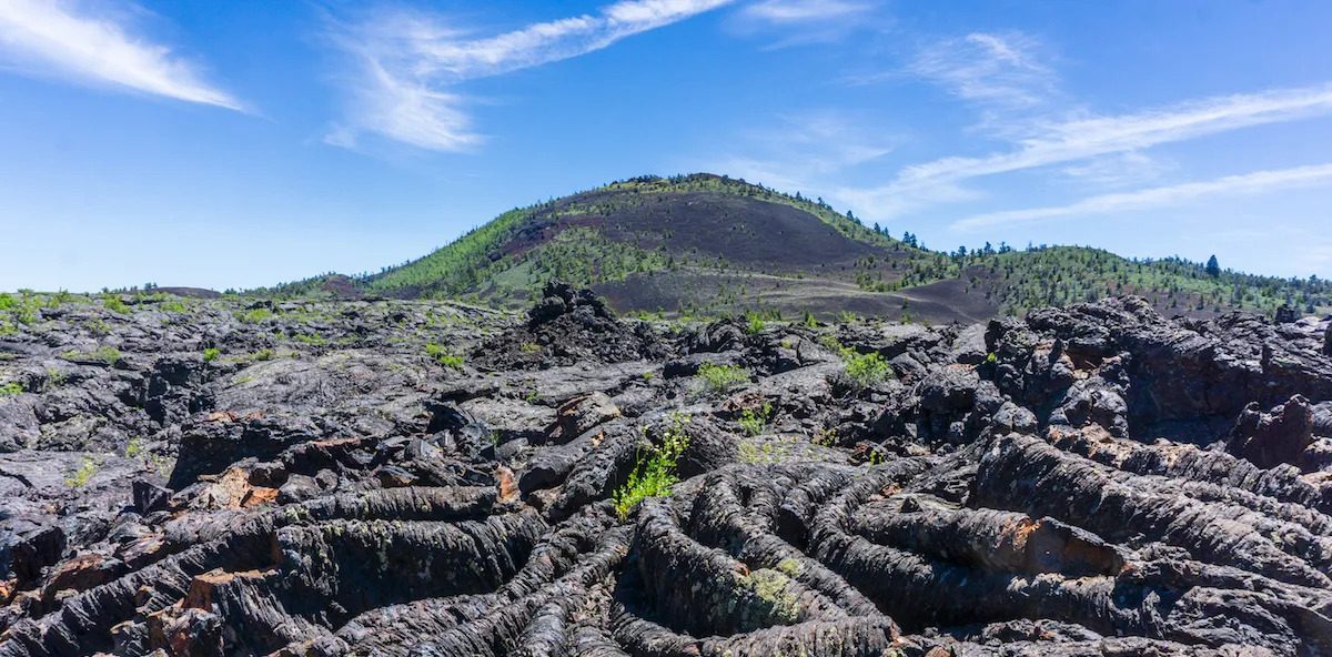
President Coolidge designated the Craters of the Moon National Monument and Preserve, which spans over 1,117 square miles in the area, in 1924 to preserve what he called “the most unusual and unearthly lunar landscapes.” The preserve encompasses a unique volcanic landscape characterized by vast lava fields, cinder cones, and lava tubes that resulted from a series of volcanic eruptions when Idaho was on the edge of the Pacific Ocean about 15,000 years ago.
Shoshone legend speaks of a serpent on a mountain who, angered by lightning, coiled around, and squeezed the mountain until liquid rock flowed, fire shot from cracks, and the mountain exploded. The flowing lava created a stark, otherworldly landscape that is now also populated with various unique plants and animals that have adapted to life in the extreme environment.
Some have said that the ocean of lava flows and cinder cone islands at Craters of the Moon is a “weird and scenic landscape peculiar to itself.” In fact, it is so unique that Apollo astronauts used the area to learn to detect good rock specimens in an unfamiliar and harsh environment.
1266 Craters Loop Road, Arco, ID 83213, 208-527-1300, Daily, 24-hours


Mackay
Surrounded by the tallest mountain peaks in Idaho, Mackay was settled in 1880, and a decade later, copper mining began. Investor John Mackay gave the mine’s general manager permission to plan any town he wished and named it after him in a show of loyalty. Along with a smelter on the Lost River, Mackay also had the Oregon Short Line Railroad build a spur from Blackfoot. Shortly after its founding, the town boasted a brick schoolhouse, two major hotels, a bank, an opera house, two churches, several lodging houses, and dozens of company-owned homes. Today, Mackay is surrounded by farms and ranches.
Destination Distinctive Accommodations
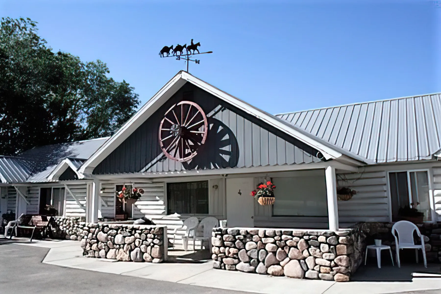
Wagon Wheel Motel and RV Park 809 Custer Street, Mackay, ID 83251 208-588-3331
The Bear Bottom Inn 412 Spruce Street, Mackay, ID 83251 208-588-2483
Destination Distinctive Dining
The Bear Bottom Inn 412 Spruce Street, Mackay, ID 83251 208-588-2483
9 Peaks Restaurant and Lounge 503 Custer Street, Mackay, ID 83251 208-569-6831
L 7 Bar and Grill, 402 West Custer Street, Mackay ID 83251 208-757-7979
Scoops Corner Cafe 221 South Main Street, Mackay ID 208-588-2158
Destination Distinctive Retail
Antiques by Alice and Bea 5475N 5780 W, Mackay ID 208-867-6066


Central Idaho Gold Level Dark Sky Reserve
The Central Idaho Dark Sky Reserve (CIDSR) is a 1,417-square-mile swath of remote, rugged lands in the Sawtooth Mountains of central Idaho. Preserving clear, unobstructed night skies over a significant area in the region, the CIDSR was the first International Dark Sky Reserve in the US and one of only a dozen worldwide. Three wilderness areas, the Sawtooth Wilderness, White Clouds Wilderness, and Hemingway-Boulders Wilderness, encompass the reserve’s core, bisected by Idaho RT-75.
Since the challenging topography of the Sawtooth Range has historically discouraged the development of major infrastructure, the land has largely resisted mass electrification and the high levels of artificial light that result, making Central Idaho one of the last significant ‘pools’ of natural nighttime darkness left in the United States. The northeast section of the reserve within Custer County is easily accessed from Mackay, to reach the forest roads that are generally open from May through November. Numerous trails lead to more remote locations for stargazing.
DAY TWO

Peaks to Craters Scenic Byway
Start in either Picabo, ID, or Challis, ID
They call it the Lost River Valley for good reason. As you travel US Highway 93 going north, between the majestic heights of the Lost River Range and the White Knob Mountains, it will feel like you are deep in the heart of the landscape.
This is the route of the Peaks to Craters Scenic Byway. The peaks just keep coming, one after the other, until you reach Mt. Borah, the highest peak in Idaho at 12,682 feet, and Dickey after that. The majestic grandeur of these mountains was created when the Pacific Plate clashed with the North American Plate when Idaho was at the edge of the Pacific Ocean and Australia lay right next to it.
These dynamic geologic events created the landscapes you will witness as you explore the Peaks to Craters Scenic Byway in southeastern Idaho. On the route, Craters of the Moon, one of the youngest volcanic areas in the region, is expected to erupt again within the next 1,000 years, coming behind the last geologic events that occurred about 2,100 years ago.
As you explore the 140-mile drive through ever-changing landscapes, you can stop to explore the ghost towns of Bonanza, Custer, and Bay Horse, quaint places where residents live a timeless Western lifestyle that has not changed much in a few centuries. This gorgeous byway adventure is said to be the most diverse stretch of road in Idaho—boasting everything from sky-piercing peaks to captivating craters along its course.
Earthquake Interpretive Site
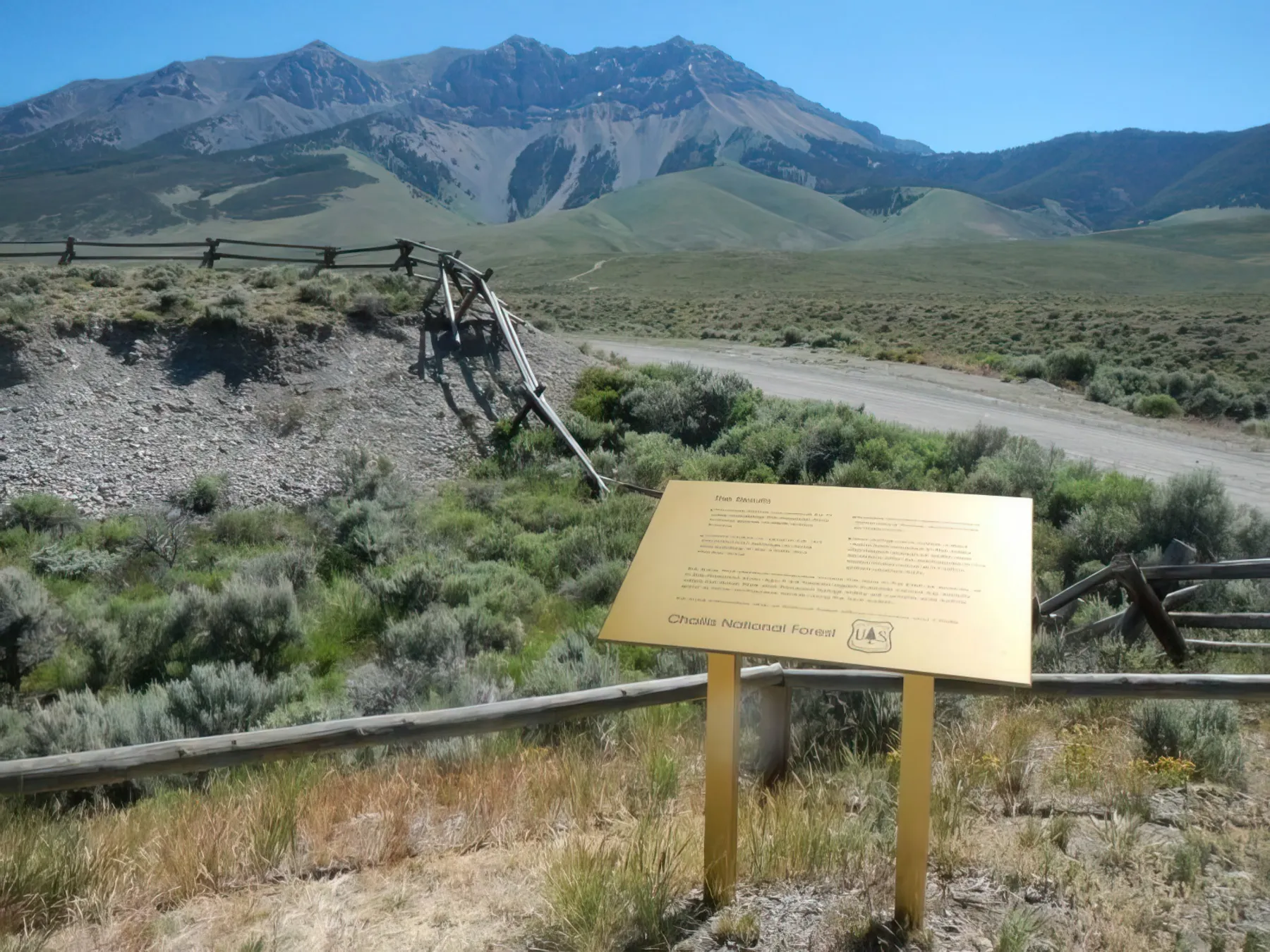
In 1983, a 6.9 earthquake, the most powerful that had occurred within the United States in over 20 years, hit the Borah Peak area causing significant damaging the surrounding region. Outdoor exhibits and interpretive panels illustrate the fault line that caused the earthquake, a replica of the summit of Borah Peak, the epicenter of the earthquake), other features of the landscape that were affected by the quake, along with the history and geology of the area, the history of earthquakes in the region, and the effects of the 1983 earthquake.
Doublespring Pass Road, Mackay, ID 83251, 208-756-5100


Borah Peak Wilderness
The Borah Peak Wilderness Area covers 47,175 acres characterized by rugged mountains, deep canyons, and alpine lakes, with elevations ranging from around 6,000 feet to Borah Peak at over 12,000 feet. The stunningly beautiful region offers hiking on the Borah Peak Trail, Chicken Out Ridge Trail, and Leatherman Peak Trail, fishing in the Salmon River and Big Lost River, mountain biking the Mackay Reservoir Trail and the Antelope Creek Trail, and horseback riding on the Fish Creek Trail and the Mill Creek Trail.
Multiple access points, including Borah Peak Trailhead, off Idaho RT-93 North of Mackay, ID, 83251
Challis
After gold was discovered in 1873, Challis was established as a stop-over and freight drop before a road was built into the newly discovered mines in the Yankee Fork Mining District. By 1896, sheepherding had replaced mining as the major industry, and the area was embroiled in the sheep and cattle wars. The mining camps eventually became ghost towns, while Challis, the seat of Custer County, flourished.


Challis Hot Springs
Volcanic activity in central Idaho did not only create mountain peaks and lush valleys. It also created hot springs from water trapped underground, still hot from the volcanic explosions, bubbles to the surface. When you reach Challis, relax in the Challis Hot Springs, enjoying the magnificent views and soothing, relaxing waters. The target temperature for the large pool is 96 in the summer and 98-100 in the winter. For customers’ safety, the pools close at the first sight of lightning or the sound of audible thunder and remain closed for 20 minutes after the last lightning is observed or thunder is heard.
5025 Hot Springs Road, Challis, ID 208-879-4442 M-Sat 8AM-9PM, Sun 8AM-6PM. $10 daily fee to swim, children 5 and under, free. All under 18 years of age must be accompanied by an adult and supervised at all times.
Destination Distinctive Accommodations
Red Rock Lodge, 610 Clinic Road, Challis, ID 83226 208-879-4936
Destination Distinctive Dining
Village Inn 310 US-93, Challis, ID 83226, 208-879-2239
Y-Inn Cafe 1200 Main Street, Challis, ID 83226 208-879-4426
Tea Cup Cafe and Bakery 200 Main Street, Challis, ID 82336 208-879-5050
Real Deal Smokehouse 810 Highway 93, Challis, ID 83226 208-369-7526

DAY THREE

Land of the Yankee Fork State Park and Interpretive Center
Yankee Fork preserves a mining camp established on the Salmon River, named because everyone in the party was a Yankee. Even though no gold was discovered immediately, prospectors stayed on and finally found gold in 1870. Soon after, the Yankee Fork Mining District was organized, and after the discovery of the General Custer Mine in 1876, the area began to flood with miners. By 1910, the three popular sites, Bonanza, Custer, and Bayhorse, were all but deserted. The interpretive center illustrates the area’s mining heritage through exhibits, a gold panning station, and audiovisual programs. The grounds also feature a ¼ mile trail detailing the archeological finds of a nearby Challis Bison Jump Site.
Junction of US 93 Milepost 244.5 and Idaho 75, Milepost 244.2 Adults $2/Family $5

